Chesapeake Energy Corporation Institutional Investor and Analyst Meeting
Wednesday, October 13, 2010 8:00 a.m. CT http://phx.corporate-ir.net/phoenix.zhtml?p=irol-eventDetails&c=104617&eventID=3305274
"I don't like to buy acreage for fair price, I like to go in and put a play together where we put our army of 5,000 landman to work, and we are buying it lease by lease for a very inefficient cost average to the rest of the industry to try and replicate and we make it a transaction where there is not a public market, it's us and the landowner and we're gonna most generally going to get the benefit of that side of the transaction, so think about again, every time we move we are buying acreage worth 5 to 10 times what we pay"
Aubrey McClendon
chief executive officer, chairman, and co-founder of Chesapeake Energy
I like quotes and one my favorites is Paul Newman's line as Jim Kane in Pocket Money, where he says to a shyster, "Boy, if somebody cheats me, I'm gonna hit 'em with a stilson wrench and shove 'em down a culvert."
LATEST EAGLE FORD OIL & GAS OVERVIEW
Road To Eagle Ford Riches:History of Big Deals & Lease Flipping & Why Your Oil Window Acreage is worth $30,000 per acre & 27 1/2% royalty
http://eaglefordinfo.blogspot.com/2010/10/eagle-ford-road-to-riches-history-of.html
Learn Why Lease Bonuses Should Go to $100,000 per acre
http://eaglefordinfo.blogspot.com/2010/11/eagle-ford-overpressure-goldilocks-oil.html
Unconventional shale plays used to carry a higher development cost than traditional drilling but not so any longer. The Eagle Ford Shale has no exploration risk, it's in the oil and gas friendly State of Texas in the USA, and located onshore in a infrastructure rich area. Contrary to popular opinion, US shale plays are cheaper to drill and produce today than traditional oil and gas plays. Operators know with a 100% certainty what each Eagle Ford well can produce before they ever spud the well.
MAPS ARE ADDED TO THE COLLECTION FROM TIME TO TIME
3/8/2011
http://www.georesourcesinc.com/PDF/CorporateProfile.pdf

added 2/14/2011 maps courtesy of DrillingInfo, Energy Strategy Partners
What is Going On Around Gonzales and Eastward? Forest, ZaZa, Penn…
http://info.drillinginfo.com/urb/eagleford/operators/2011/03/what-is-going-on-around-gonzales-and-eastward-forest-zaza-penn/


added 1/30/2011

added 1/29/2011

added 1/25/2011

added 1/13/2011
latest Forest Oil presentation http://www.forestoil.com/downloads/present_bmo_cm_jan2011.pdf

added 1/10/2011

added 1/4/2011


The Sweet Spot of the overpressure oil window containing the most highly prized 35-45 degree WTI crude oil has been confirmed to exist along the corridor that runs parallel with the axis of the orange line on the map. This oil window corridor extends into Lavaca and Fayette County. The associated acreage contains the highest grade crude oil in the entire Eagle Ford trend and provides operators with the best economics. It is where the Eagle Ford formation has undergone the most favorable geologic conditions producing the highest grade crude oil there is in the entire trend. As you move South and West along the trend towards the Maverick Basin, the oil in place becomes heavier, eventually becoming uneconomic to produce in a large area near the Texas-Mexico border.
- Light crude oil is defined as having an API gravity higher than 31.1 °API. (less than 870 kg/m3)
- Medium oil is defined as having an API gravity between 22.3 °API and 31.1 °API. (870 to 920 kg/m3)
- Heavy oil is defined as having an API gravity below 22.3 °API. (920 to 1000 kg/m3)
- Extra heavy oil is defined with API gravity below 10.0 °API. (greater than 1000 kg/m3)
http://www.eogresources.com/investors/investor_pres.html
added 12/23/2010
from Drillinginfo.com http://info.drillinginfo.com/urb/eagleford/operators/2010/12/sugarkane-corridor-producing-the-best-wells-in-the-trend/comment-page-1/#comment-74

added 12/21/2010
a very interesting Eagle Ford article with the following two maps are from http://www.oilspillupdates.com/oil-spill-news/tech-talk-when-oil-isn%E2%80%99t-crude-and-gas-isn%E2%80%99t-gas-the-eagle-ford-shale-play/


added 12/20/2010

added December 12, 2010

map added 12/08/2010

Current RRC Field Rules for Eagle Ford District 2, DeWitt County

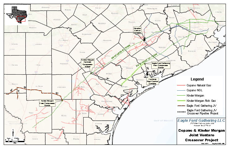
Energy Transfer Partners pipelines map addeded 11/17/2010

Pioneer map added 11/15/2010

EOG drilling locations 11/11/2010

Added 11/11/2010

Added 11/07/2010

Added 11/02/2010

RSEG maps added on 11/01/2010

RSEG maps

new RSEG map

new RSEG map

new RSEG Map


Texas Railroad Commission map of
Wells Permitted and Completed as of 10/06/2010

the latest maps added to this collection come to us from drillinginfo.com/eagleford/


geology of the Eagle Ford


Posted on 10/12/2010
 a
a


I just want to say thank you for all of this info and keep it coming. It is very helpful!
ReplyDeleteWhat is your problem? Landowners are receiving more money today from leasing their property than their land was worth two years ago. We are doing landowners a favor. What part of nobody is holding a gun to their head do you not understand?
ReplyDeleteYou should tweet when you add maps and new posts. Thanks, you have a great website. We appreciate what you do.
ReplyDeleteThank you, thank you, thank you. God bless you for doing this.
ReplyDeleteI appreciate all the compliments I receive for compiling this blog. I understand the reluctance of some landowners to contact me directly but I want everyone to know that I don't, and I won't, share your personal information with others, be they lawyers, land agents, landman, or whatever. Some of you tell me what I am doing is a public service. I consider it almost my responsibility to report what I learn. I hope each of you who read this blog gain something to help you negotiate an oil and gas lease that is fair and equitable to all concerned. Those who have already signed bad leases should not beat themselves up over it, it was not your fault that you were taken advantage of.
ReplyDeleteKeep up the good work, we appreciate all you do.
ReplyDeleteIt would have nice to have these maps a couple of years ago when most of us were being leased.
ReplyDelete